


NOBLE 11, Wabash County, Indiana
About
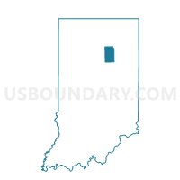
Outline

Summary
| Unique Area Identifier | 581069 |
| Name | NOBLE 11 |
| County | Wabash County |
| State | Indiana |
| Area (square miles) | 38.29 |
| Land Area (square miles) | 38.14 |
| Water Area (square miles) | 0.15 |
| % of Land Area | 99.62 |
| % of Water Area | 0.38 |
| Latitude of the Internal Point | 40.79995000 |
| Longtitude of the Internal Point | -85.89820940 |
Maps


Graphs
Select a template below for downloading or customizing gragh for NOBLE 11, Wabash County, Indiana


Neighbors
Neighoring Voting District (by Name) Neighboring Voting District on the Map
- BUTLER, Miami County, IN
- ERIE, Miami County, IN
- NOBLE 01, Wabash County, IN
- NOBLE 05, Wabash County, IN
- NOBLE 07, Wabash County, IN
- NOBLE 09, Wabash County, IN
- NOBLE 10, Wabash County, IN
- PAW PAW, Wabash County, IN
- RICHLAND, Miami County, IN
- WALTZ, Wabash County, IN
Top 10 Neighboring County Subdivision (by Population) Neighboring County Subdivision on the Map
- Noble township, Wabash County, IN (14,230)
- Paw Paw township, Wabash County, IN (1,691)
- Waltz township, Wabash County, IN (1,287)
- Richland township, Miami County, IN (1,179)
- Butler township, Miami County, IN (866)
- Erie township, Miami County, IN (554)
Top 10 Neighboring Place (by Population) Neighboring Place on the Map
Top 10 Neighboring Unified School District (by Population) Neighboring Unified School District on the Map
- Maconaquah School Corporation, IN (15,358)
- Peru Community Schools, IN (13,582)
- Wabash County Schools Metropolitan School District, IN (13,203)
- Wabash City Schools, IN (9,264)
- North Miami Community Schools, IN (6,007)
Top 10 Neighboring State Legislative District Lower Chamber (by Population) Neighboring State Legislative District Lower Chamber on the Map
- State House District 32, IN (63,192)
- State House District 23, IN (60,512)
- State House District 22, IN (57,862)
Top 10 Neighboring State Legislative District Upper Chamber (by Population) Neighboring State Legislative District Upper Chamber on the Map
Top 10 Neighboring 111th Congressional District (by Population) Neighboring 111th Congressional District on the Map
Top 10 Neighboring Census Tract (by Population) Neighboring Census Tract on the Map
- Census Tract 9520, Miami County, IN (4,767)
- Census Tract 9521, Miami County, IN (4,438)
- Census Tract 1029, Wabash County, IN (3,750)
- Census Tract 9526, Miami County, IN (3,745)
- Census Tract 1028, Wabash County, IN (3,481)
- Census Tract 1024, Wabash County, IN (3,336)